
Heading for Alaska: Beautiful British Columbia (plus a Lookback to Arkansas)
- Alison (No Fixed Address)

- Jul 22, 2025
- 10 min read

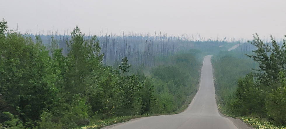
From the town of 100 Mile House, 240 miles north of the U.S. border, we continued north through British Columbia, headed for Mile 0 of the Alaska Highway in Dawson Creek. This drive paralleled and crossed over river after beautiful river: Fraser, Crooked, Parsnip, Misinchinka, Pine. We also passed stunning lakes: la Hache, Williams, McLeese, Summit, McLeod.


British Columbia is proud of its history and heritage. Even smaller towns had visitor centres and museums.


Besides waterways and history, we also had our first wildlife sightings in British Columbia: 18 bears, including two cubs; 4 moose, including two calves; and 3 herds (and 3 smaller groupings) of wood bison, including calves. The pictures, alas, do not really capture what a thrill it is to see these animals striding through a swamp, or munching on dandelions by the road, or gamboling after their mother:


The North Country is as proud of its wildlife as it is its history. Everywhere we went - museums, gift shops, visitor centres, camping lodges - taxidermied wildlife was on display. Most was carefully labeled to indicate that it was a very old taxidermy or was obtained when the animal accidentally died.

One of the standout stops we made in British Columbia was Chetwynd, on the John Hart Highway south of Dawson Creek. Chetwynd is the site of the annual International Chainsaw Carving Championship, and we - completely by chance! - were there for this year's competition. Twelve international carvers (four Canadian, four U.S., four other international) are given an eight-foot tall, four-foot thick western red cedar trunk, and have 35 hours to complete a sculpture of their own design. They are allowed to use various cutting tools and wood glue. We were in town and could watch the process on two of the middle days.


Continuing north from Chetwynd, we reached Dawson Creek, British Columbia. This is the official start of the Alaska Highway. Originally some 1,700 miles long when completed in 1942 (the route has been straightened and shortened over the years since), construction of the ALCAN ("Alaska-Canada Highway") was a reaction to the December 7, 1941 attack on Pearl Harbor Naval Base in Hawaii by Imperial Japan. The U.S. and Canada had been discussing such a road for ten years, but the need became imperative as WWII developed a Pacific Theatre of operations. The U.S. already had air bases along the route, used to ferry Lend-Lease aircraft to the Soviet Allied Forces, but no road for military land vehicles. In just eight months, from March through October of 1942, the U.S. Army Corps of Engineers cleared a rough road (including over 330 pontoon or log bridges and some 8,000 culverts) from Dawson Creek, British Columbia to Delta Junction, Alaska, where it intersected the already existing but unpaved Richardson Highway that linked Valdez, Alaska on the south-central coast and Fairbanks, Alaska in the east-central interior. Next, the U.S. Public Roads Administration oversaw improvements and maintenance (widening, adding gravel and crushed stone surfacing, and building permanent bridges). The highway was ready to be driven by regular military vehicles beginning in 1943, and was finally converted to civilian use in 1948. By the late 1980's or early 1990's, the entire route had been paved, but it stays that way only with constant road repair, due to the harsh weather conditions and the thawing/freezing permafrost underneath many sections.


Our plan at this point was to drive north on the Alaska Highway. But summer wildfires had other plans. After the Summit Lake and Pocket Knife Creek fires intermittently closed the Alaska Highway over several days, we decided to backtrack to Prince George, then drive another day west, then drive north for two days on the Cassiar Highway. What was a necessity became a joy - it was an absolutely gorgeous drive.


We were checking drivebc.com throughout each day we were in Dawson Creek, British Columbia.


The Cassiar Highway rejoins the Alaska Highway just north of the British Columbia/Yukon provincial border. Our plan was to continue our journey north on the Alaska Highway; but we decided to postpone that for a few days to fit in a day trip a couple hours south on the Alaska Highway to Liard River Hot Springs. The wildfires had kept us from traveling north to Liard, but the small amount of backtracking that would now be required to visit the hot springs was worth it! The Liard River Hot Springs, two large natural pools reached via a boardwalk in a lush provincial park, are well-known and came highly recommended - and rightly so!


From here, we would turn north again, traversing the Canadian province of Yukon on our way to Alaska.
Looking Back: May and June 2024 in Arkansas
Almost exactly a year before visiting Liard River Hot Springs, the two of us had spent a week in the city of Hot Springs, Arkansas.
The area that is now Arkansas was originally part of the Louisiana Purchase, those 530 million acres purchased from France in 1803 during the Presidential administration of Thomas Jefferson. (Although France nominally owned the area, having purchased it back from Spain in 1800, it actually controlled very little of the territory; Spain controlled some, and indigenous American tribes controlled the rest, though not for long.) In 1812, the major portion of the Louisiana Territory was renamed the Missouri Territory when the State of Louisiana was split off and admitted to the Union. In 1821, when Missouri became a state, Arkansas was split off into its own territory and the remaining acreage became an unorganized territory that would eventually be divided into other territories and finally states. In 1836, Arkansas became the 25th state in the Union; from 1861 through 1868, it was a member of the Confederacy.

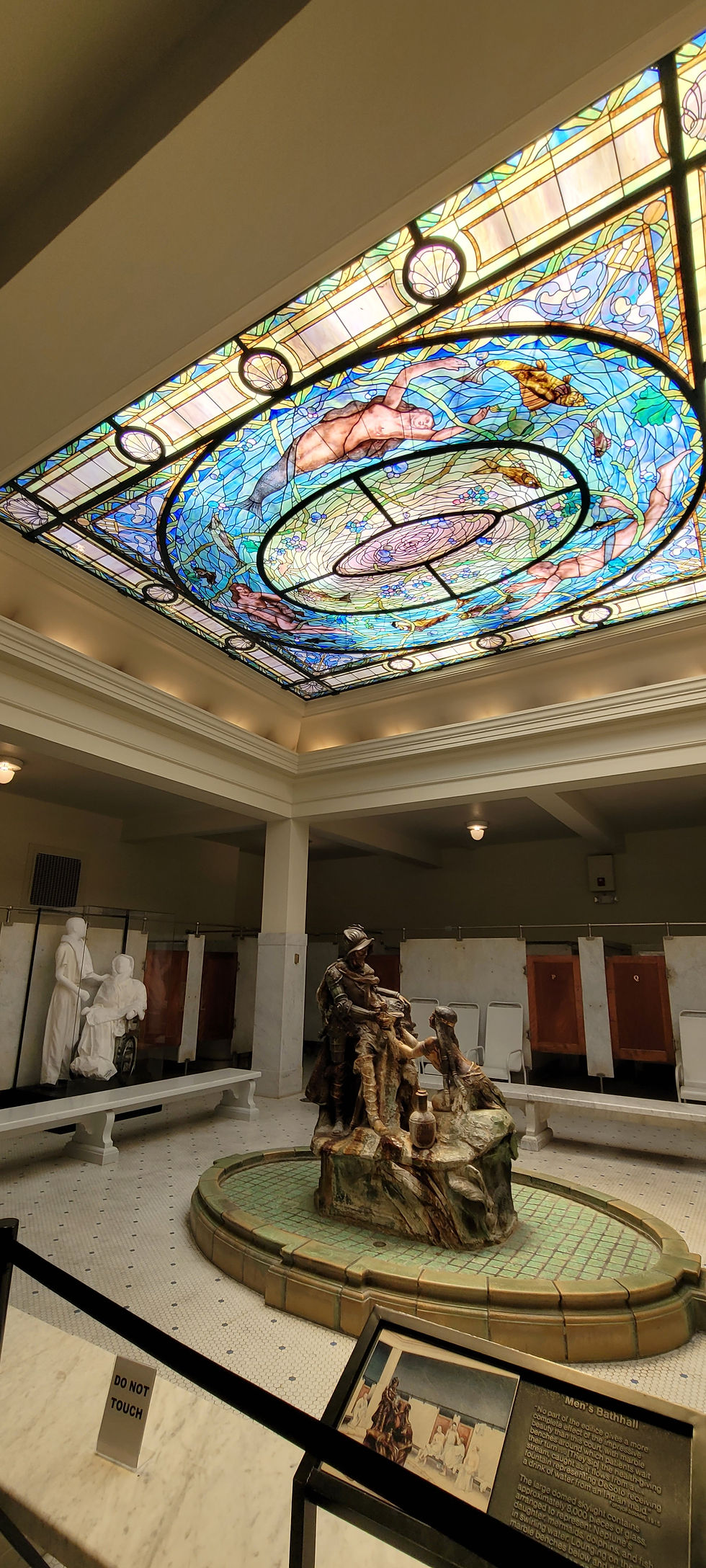
The city of Hot Springs, Arkansas, grew up around the steaming (143 degrees Fahrenheit!) springs, which had been attracting people for hundreds of years. Americans began erecting rudimentary shelters at the springs in the first decade of the 1800's. The indigenous Quapaw tribe formally surrendered the lands around the hot springs to the U.S. federal government in 1818, and the territorial government requested that the springs and surrounding Ouachita Mountains be declared a federal reserve in 1820. Twelve years later, in 1832, the U.S. Congress obliged. After the U.S. National Park Service was established in 1916, the Hot Springs Reservation was designated the eighteenth National Park.

Because not much oversight came with the designation of the springs as a federal reservation, private entrepreneurs continued to develop the hot springs, often in haphazard ways, including open wooden troughs carrying hot water down the hillsides to rough wooden structures. Much of this was destroyed in a large 1878 fire, and subsequent construction was overseen by the federal government. Roads and landscaping were improved; the springs were protectively covered, and sewage measures put into place; luxurious Victorian bathhouses were built, first of wood and then of brick, stucco, and marble. America's spa city was born, attracting tourists, invalids, gamblers, mobsters (including Al Capone, "Bugsy" Siegel, and "Lucky" Luciano), and Major League Baseball spring training teams (including famous players Babe Ruth and Ty Cobb).
Today Hot Springs National Park, separate from (but physically contiguous to) the town's downtown, is the second smallest National Park at 5,542 acres (only Gateway Arch National Park, in St. Louis, Missouri, has a smaller footprint). (For comparison, the largest National Park, Wrangell-St. Elias in Alaska, comprises over 8.3 million acres for the National Park and an additional 4.8 million acres for the National Preserve.) Hot Springs National Park includes Bathhouse Row, with eight grand old bathhouses, two of which are still active, two of which serve the National Park as a museum and a gift shop, and four of which have other commercial tenants. The town also includes historic hotels and other buildings, such as the Army-Navy Hospital (1887-1960, then used as a state rehabilitation center through 2019).
We enjoyed our stay in Hot Springs, e-biking in from our campground to tour Bathhouse Row, including the Fordyce Bathhouse Visitors Center and Museum, and to soak in the pools at the Quapaw Baths & Spa. The Quapaw's four large pools are kept at slightly different temperatures (by hot springs water being mixed with different amounts of filtered cold springs water) so that you can move from muscle-relaxing high heat to soothing warmth.


We might have to return to Hot Springs, Arkansas, some time to visit the sites we didn't have time for on this trip: the historic Arlington Hotel, the Gangster Museum of America, and the Historic Baseball Trail.


Comments